top of page
Aviocene
The aim of this project is to monitor heavy metal pollution in urban areas using a biosensing drone. The drone converts microbial reactions into visible warning signals by combining color-changing Bacillus subtilis with onboard cameras and microcontrollers. As a result, invisible environmental risks become noticeable at the city scale.
Background
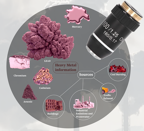
Heavy Metal Pollution
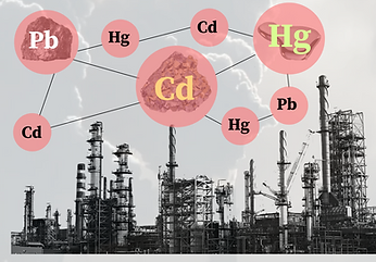
The effect of heavy metal pollution is a critical environmental issue worldwide. In most areas, low levels of heavy metals such as lead, cadmium, and mercury build up unobserved in rivers and agricultural fields. This changes the color of the soil and habits of wildlife.

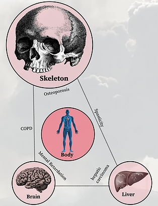
Environmental & Physical Impact
The effect of heavy metal pollution is a critical environmental issue worldwide. In most areas, low levels of heavy metals such as lead, cadmium, and mercury build up unobserved in rivers and agricultural fields. This changes the color of the soil and habits of wildlife.

Research
Global Heavy Mental Pollution Timeline
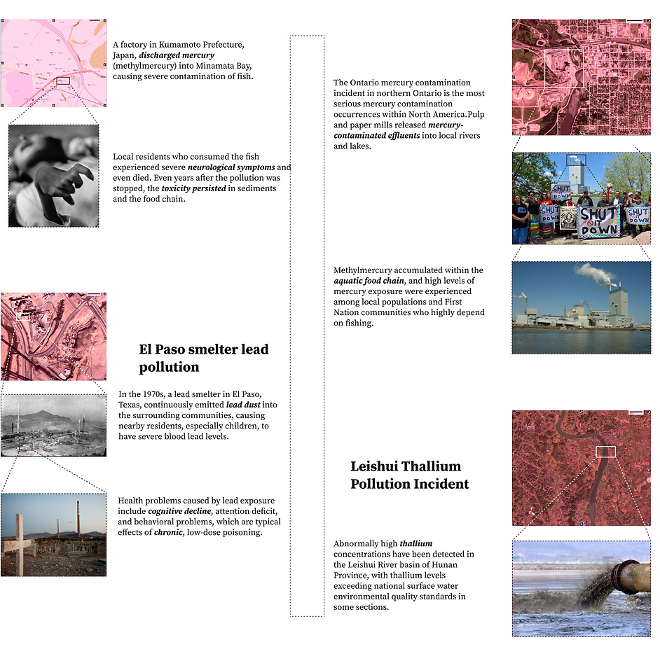
Global Heavy Mental Pollutionm map

What are these bacteria?

Experimental Objective

How to do

Experimental results

The graph clearly shows that the proportion of bacteria showing discoloration gradually increases with the increase in heavy metal dosage. The control group, which did not contain lead carbonate, showed no discoloration. This demonstrates the feasibility of using Bacillus subtilis for heavy metal detection.
Concept
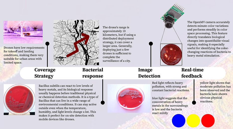
By utilizing the color-changing reaction of Bacillus subtilis with heavy metals, we can use it as a tool to monitor heavy metal pollution. I will design a drone platform that incorporates Bacillus subtilis, a camera sensor, and a light warning system. After the camera detects a color change in the bacteria, the camera will activate a light to indicate the detection. Different colors of light will represent different levels of pollution.


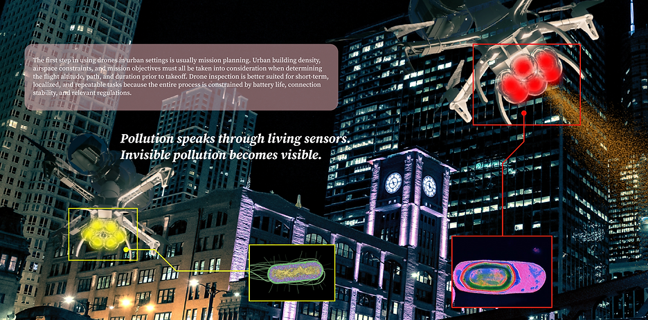
The drone system has a maximum flight altitude of 120 meters and is built and operated in compliance with standard civil aviation safety regulations. The drone can obtain a comparatively wide field of view at 120 meters, which greatly enhances its coverage of the terrestrial environment and allows it to monitor a greater area in a single flight.
Design Details
Product Map

Technology
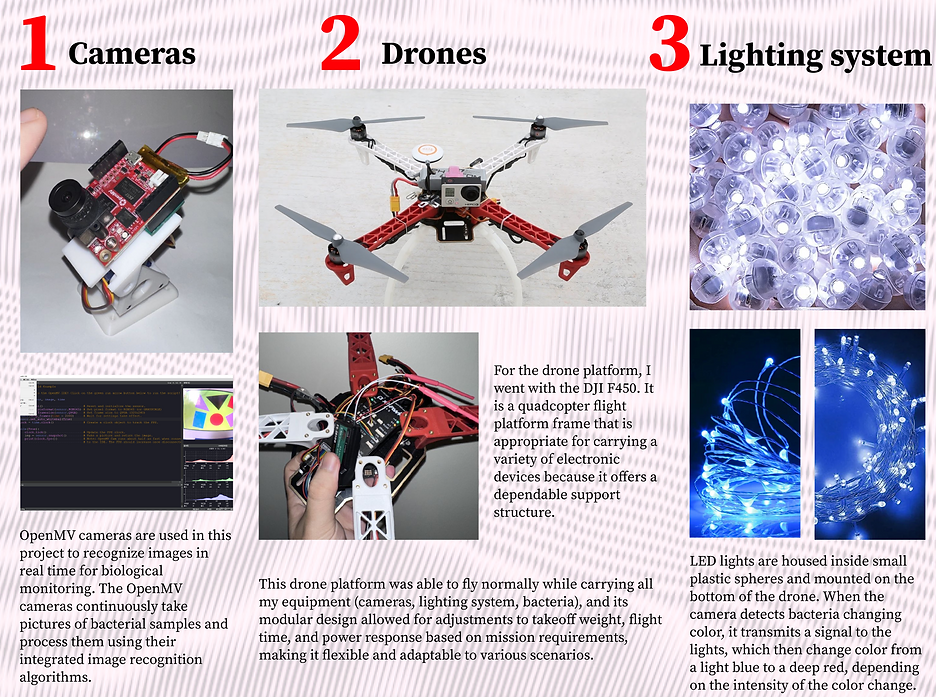
To accomplish thorough data collection and analysis, this project makes use of a number of cutting-edge technologies, including cameras, drones, lighting system and image recognition.
Scenario

bottom of page